Statistik
TAHUN 2012
| Wisatawan Domestik : 1.000 Orang |
|
| Wisatawan Mancanegara : 2.000 Orang |
TAHUN 2013
| Wisatawan Domestik : 1.000 Orang |
|
| Wisatawan Mancanegara : 2.000 Orang |
TAHUN 2014
| Wisatawan Domestik : 1.000 Orang |
|
| Wisatawan Mancanegara : 2.000 Orang |
TAHUN 2015
| Wisatawan Domestik : 1.000 Orang |
|
| Wisatawan Mancanegara : 2.000 Orang |
TAHUN 2016
| Wisatawan Domestik : 1.000 Orang |
|
| Wisatawan Mancanegara : 2.000 Orang |
TAHUN 2017
| Wisatawan Domestik : 1.000 Orang |
|
| Wisatawan Mancanegara : 2.000 Orang |
In a Nutshell
Savu is located in the Lesser Sundas of eastern Indonesia (Nusa Tenggara Timur) half way between Sumba and Timor. The Savu archipelago includes Savu, Raijua and Dana and gave its name to the sea bordering Flores, Timor and Sumba. The Savu archipelago is part of the Savu Sea Marine National Park, whose aim is the protection and conservation of all types of marine mammals such as whales, dolphins, dugongs and turtles.
The Climate is dry for most part of the year. The rainy season from December to March brings irregular, but heavy rain and its share of floods near the coasts. Due to the scarcity of water the island produces few agricultural goods. It does allow one harvest of corn, mung beans, sorghum, tubers (cassava, taro), and cucurbitaceae (gourds, pumpkin, cucumber). Wet rice is restricted to the fewareas of the island which can be irrigated.
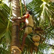
During the six to nine months of the dry season all river beds are dry and water supply is a main concern in the archipelago. The dry season is known here asawe menganga (musim lapar, B.I.), the hungry season. The sap the lontar palm tree provides an essential source of nutrition
Savu has numerous white sandy beaches, protected by reefs. Some beaches played a role in history like the beach between the harbour of Seba and the walled village of Bodo; it served as a landing place for Captain James Cook and his crew in 1770.
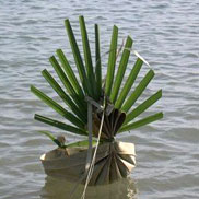
The beach of Uba Ae in Mesara hosts the most important ceremony of the year, kowa hole, where a ceremonial boat is launched out to sea.
Uba Ae in Mesara, as well as beaches of Raijua, is visited by surfers.
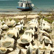
Gathering of sea food on reefs, small scale fishing activities, gathering of sea salt, sea weeds farming. Sea salt gathering using large shells or lontar containers has been a traditional activity on Savu and Raijua. In the last fifteen years seaweed farming has developed along the west and southeast coasts, bringing a new source of revenue to those living near the beaches.
Things to DO at Sabu Raijua
-
-
Wisata Alam
If the genealogies transmitted by the priests are used as a means of measuring time, Savu�s memory goes back to the first millennium CE (Sriwijaya period)
-
Wisata Bahari
To see in a half day : Around Seba: Bodo (beach and village), Namata. To visit in a day: West Savu, East Savu, Liae. Walking tours from Seba
-
Wisata Budaya
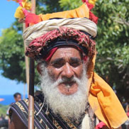
The large majority of the population is Christian; A small community of Moslems live near the harbour and in the town of Seba. Around 10% of the population follow the traditional a ...
-
-
-
Wisata Buatan
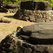
The megaliths of Savu are natural wonders. They are not burial places, but physical time markers. They were dragged to ritual places from various parts of the island.
-
Kalender Adat
Each domain of Savu has its own ritual calendar (kalender adat or kewèhu rai, the knots of the land) as well as a specific number for calculating the day of a ritual in the lunar m ...
-
Upacara Adat
A village of origin or rae kepue is (or was) fenced, has a number of houses of the type èmu rukoko, a ritual place and sacred stones
-
-
-
Tarian Tradisional
Ceremonies of the adat calendar are linked to the traditional religion Jingi tiu. They are held for the well-being of the population, for connecting people with their ancestors
-
Agama Suku
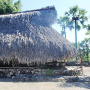
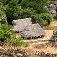
Traditional houses on Savu bear witness to a rich historical and cultural legacy. Today they still can be seen in all parts of the island, fulfilling their purpose as identity mark ...
-
Tenunan
The lontar palm tree has been for centuries the tree of life for the Savunese who drink its sap during the dry season. Every part of the tree is used in everyday life and for cerem ...
-
-
-

